
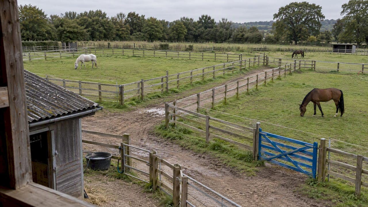
The best way to map paddock boundaries on a horse property is to walk each fence line with a GPS receiver, name every paddock with a simple numbered code, and then store the result somewhere your whole team, your vet and emergency crews can reach it, even without mobile coverage. Drawing lines over a satellite image is faster, but it is only a starting point. This guide covers both methods, how accurate each one is, what a yard map needs beyond fence lines, and how to keep it alive once it is built.
TL;DR
- Desktop drawing over aerial imagery is quick and fine for a first draft. A GPS walk of the boundary is the method to trust when the numbers matter.
- Name paddocks with short numeric labels (Paddock 01, Paddock 02), not descriptions like "the back one near the oak".
- A yard map should show gates, water, hazards, utility shut-offs and vehicle routes, not only fences.
- Keep a waterproof printed copy at the main gate and a digital copy that works offline.
- Review the map whenever a fence moves, a paddock is split or a hazard changes.
Table of Contents
- Why paddock boundaries are different from property boundaries
- Three ways to map a paddock
- Name paddocks so the system, and your team, can use them
- What a yard map needs beyond fences
- Make the map reachable when nobody is there
- Keep the map live
- Our perspective: a paddock map should be a working tool, not a drawing
- Putting your map to work in EquiBETS
- A one-weekend mapping plan
- FAQ
- Sources
Why paddock boundaries are different from property boundaries
Your title boundary is recorded by the council or state land registry. Paddock boundaries are not. CSIRO makes the point plainly when describing its ePaddocks project: paddock boundaries have historically not been recorded anywhere, and farm software has typically required people to draw them by hand for every service they use.
That gap is yours to fill. On a professional horse yard, the paddock layer is where daily work happens: which horses are turned out where, which paddock is resting, where the hay goes, which gate a farrier should use. If that knowledge lives in one head, or on a hand-drawn sketch in the tack room, it fails the moment that person is off for the weekend.
There is also a shift in how the word "boundary" is used. As John Deere's Australian boundaries Q&A explains, it once meant a post and wire fence, whereas in a digital context it means a map of each field on the farm. For a yard, that digital boundary can drive record keeping, turnout rosters, feed planning and emergency information.
Three ways to map a paddock
1. Draw it on aerial imagery
Open a satellite view, trace each paddock as a polygon and label it. It takes minutes per paddock, costs nothing in equipment and gives you a visual you can share straight away.
The weakness is positional error. Imagery can be out of date (a fence moved last year will not show), shadows and tree canopy hide the real line, and small offsets add up. Deere's guidance notes that drawing lines on a computer map is often not enough where operational precision matters, because of map drift.
A useful reference point comes from an academic study of positional accuracy at the Coleambally Irrigation Area. It found that processing high-resolution aerial imagery could produce datasets meeting professional accuracy standards, with individual paddock area estimates around plus or minus 5% at a 90% confidence level. That is a 2004 study of irrigated cropping paddocks, not horse yards, so treat it as an indication of what well-processed imagery can do, not a promise for a quick trace on a phone.
2. Walk the boundary with GPS
Walk, ride or drive the fence line with a GPS receiver and record the track. The same Deere guide describes this as the most accurate method, and says a receiver using an RTK correction signal gives repeatable accuracy of about 2.5 centimetres. A phone on its own will not reach that, and you do not need it to for most yard tasks.
What you do need is an honest match between the method and the job:
| Job | Phone GPS walk | Aerial tracing | RTK receiver |
|---|---|---|---|
| Turnout rosters and paddock names | Good | Good | Overkill |
| Approximate paddock area for stocking and feed | Reasonable | Reasonable | Best |
| Telling a vet where a horse is down | Good | Fair if imagery is current | Overkill |
| Fencing quotes and fertiliser or irrigation work | Check first | Not advised alone | Best |
For a typical horse property, a phone walk to capture the real fence line plus aerial imagery for context covers most needs. Step up to RTK only if you are automating irrigation, spreading fertiliser by prescription or measuring areas for contractor quotes.
3. Combine them and ground-truth
The approach most professionals settle on is to draw first, then verify on the ground. A crop-mapping report from Cropland Analytics on open agricultural maps and ground-truth data stresses ground-truthing, meaning checking the map against real conditions, so that boundaries overlapping trees, roads or other features do not degrade the data. On a yard, that translates to a simple habit: after you draw a paddock, stand at its corners and confirm the polygon matches the fence you can see.

Name paddocks so the system, and your team, can use them
Naming looks trivial and causes more daily friction than almost anything else. A Cornell factsheet on field boundary maps is a good reference on why fields need consistent identification for staff, applicators and consultants. Practitioners generally recommend short, numeric identifiers over long descriptive names because they cut ambiguity and speed up data entry on a phone.
A workable convention for a yard:
- Number paddocks in a fixed direction, for example north to south, starting at the main gate.
- Use two digits so lists sort properly: Paddock 01 to Paddock 12.
- Keep descriptive detail in a notes field ("shelter shed, laneway access"), not in the name.
- Never reuse a number. If you split Paddock 04, create 13 and 14, and retire 04.
- Paint or tag the number on the gate so the map and the ground agree.
Your casual names will survive on the ground for a while. That is fine, as long as the app, the roster and the emergency map all use one set of labels.
What a yard map needs beyond fences
A farm map for production only has to show the paddocks. A yard map has to work when something has gone wrong. Animal Health Canada's farm site mapping guidance says a site plan can start as a one-page aerial photo or a hand-drawn schematic, and that good maps note utility lines, drainage, hazards such as chemicals and manure, and vehicle access points.
For a horse yard in Australia, build these layers:
- Entry points and gates, with the gate you want responders to use marked clearly, and any locked gates noted with who holds the key or code.
- Water: troughs, tanks, dams and hydrants, plus firefighting water sources.
- Shut-offs: mains power, gas, bore pumps and water mains.
- Hazards: fuel, chemicals, hay sheds, gas bottles, old machinery, overhead lines.
- Vehicle routes: where a float, ambulance or fire truck can drive, turn around and not bog.
- Holding areas: yards and paddocks where horses can be moved safely.
- Address and GPS coordinates, written on the map itself.
The Northwest Horse Source article on seeing your property through a veterinarian's eyes suggests looking at the property as a visitor would: where might an ambulance or heavy vehicle get stuck or be unable to turn? Do that drive-through once, ideally in wet conditions, and you will find problems no satellite image shows.
For the deeper emergency side, our guides on evacuation route maps for stables and yards and stable hazard mapping that stays live go through layout and priorities step by step. If you are drafting a barn fire plan, a posted action sheet and map is more useful than a folder nobody opens.
Make the map reachable when nobody is there
An excellent map is useless if the only copy is on a laptop in the office. The same Northwest Horse Source piece recommends making a map to hand to emergency personnel, using aerial photos where possible and laminating it. A Louisiana livestock emergency guide, the North Louisiana All Hazards Livestock Disaster guide, goes further and suggests keeping the farm map in a sealed PVC pipe attached to a fence so first responders can reach it. Those are US sources, but the logic holds on any Australian property, particularly one with long driveways and multiple gates.
A practical setup:
- Print the map on A3 and laminate it, or use waterproof paper.
- Put it in a capped pipe or weatherproof sleeve at the main gate, away from direct sun.
- Write the property address, GPS coordinates and an after-hours contact on it.
- Keep a second copy in the tack room and one in the main vehicle.
- Keep a digital copy on every staff phone that works with no signal.
That last point matters in rural Australia, where coverage drops out in the very paddocks you are trying to describe. We cover the connectivity side in offline-first rural stable connectivity and the data side in offline data capture for professional yards and vets.
Train people to use the map
A map only helps if people know what it shows. Staff, regular contractors and anyone who may be first on scene should know where it lives and how to read it. If you run a team, a short first aid and risk assessment briefing is a sensible place to rehearse this, and a first aid training risk assessment guide for employers is a useful reference when you work out which site details to cover. Walk new staff around the property with the map in hand on their first day.
Keep the map live
Static maps decay. A fence moves, a paddock is split, a new hay shed goes up, a gate is padlocked. Within a season the printed copy at the gate quietly becomes wrong, and wrong is worse than missing because people trust it.
A simple maintenance rhythm:
- Trigger updates: any fence change, new building, new hazard or new access arrangement.
- Quarterly check: one person walks the property with the map and marks differences.
- Reprint rule: whenever the digital map changes in a way that affects emergency access, reprint the gate copy the same week.
- One owner: name a person responsible, so it does not belong to everyone and therefore no one.
This is where a digital boundary beats a paper one. Change it once and everyone sees it. That is the shift Deere's guide describes: from a static fence to a dynamic digital boundary that can support geofencing and task-based automation, which hard-copy maps cannot.
Our perspective: a paddock map should be a working tool, not a drawing
We build EquiBETS for professional yards, and the pattern we see is consistent: the map is treated as a one-off project. Someone draws it, it gets pinned on a wall, and it is out of date by the next season. The paddock then lives in people's heads, which is exactly where information is lost when staff change or an emergency hits.

We think a good yard map earns its place by being connected to the daily work. The paddock a horse is in should sit beside its record, its feed plan and its owner updates. The hazard layer should be the same one that feeds the emergency plan your vet and responders can open. And because yards are rarely in places with great signal, all of it has to work offline and sync later.
Our advice is to resist over-engineering. Start with a phone walk of each fence line, number the paddocks, add gates, water and hazards, and print a waterproof copy for the gate. Add precision only where a task demands it. For the connected side, our guides on GPS horse tracking for Australian owners and a digital horse emergency plan show how mapping links to riding data and emergency information.
— isaac
Putting your map to work in EquiBETS
EquiBETS brings farm mapping, horse records, team chat, owner portals, feed planning and emergency plans into one workspace, with an offline-first mobile app and GPS tracking for rides. There is one plan, EquiBETS Complete, at 9.99 AUD per month, with every module included and a free trial before you subscribe. See the details on the EquiBETS pricing page, or read how offline horse management software cuts owner calls.
A one-weekend mapping plan
If you are starting from nothing, this sequence gets a usable map done in a weekend:
- Saturday morning: trace each paddock on current aerial imagery and assign numbers.
- Saturday afternoon: walk the fence lines with a phone, correct the polygons and mark gates, troughs and shut-offs.
- Sunday morning: drive the access routes the way a float or ambulance would, noting boggy corners, tight turns and low branches.
- Sunday afternoon: add hazards, print and laminate the gate copy, and load the digital version onto staff phones.
- The following week: have your vet or a neighbour read the map cold and tell you what is unclear.
That last step is the cheapest quality check available. If someone who has never been to your property can find the right gate and the nearest water from the map alone, it works.
FAQ
How accurate does a paddock map need to be?
For turnout, rosters and emergency navigation, a careful phone GPS walk is enough. For fencing quotes, irrigation or fertiliser application, accuracy matters more, and Deere's guidance points to RTK receivers with about 2.5 centimetres of repeatable accuracy. Match the method to the task rather than defaulting to the most expensive one.
Can I just draw my paddocks on a satellite image?
Yes, as a first draft. Imagery can be out of date and tree cover can hide the real fence line, so check each polygon on the ground before relying on it. Ground-truthing is a standard step in agricultural mapping for exactly this reason.
What should I include on a map for emergency services?
Include the property address and GPS coordinates, the gate responders should use, water sources, utility shut-offs, hazards such as fuel and chemicals, and routes a heavy vehicle can drive and turn on. Keep a waterproof copy at the main gate in case no one is on site.
How should I name my paddocks?
Use short numbered names such as Paddock 01 and Paddock 02, and put descriptions in a notes field. Numeric labels avoid confusion between staff and make data entry on a phone quicker. Do not reuse a number once a paddock is retired.
How often should I update the map?
Update it whenever a fence, building, gate or hazard changes, and do a full walk-through check each quarter. Reprint the gate copy whenever emergency-relevant details change.
Sources
- CSIRO: ePaddocks, mapping every paddock across the Australian grain region
- John Deere Australia: Know your boundaries Q&A
- Assessing and Improving Positional Accuracy and its Effects on Areal Estimation at Coleambally Irrigation Area
- Creating Open Agricultural Maps and Ground Truth Data to Better Deliver Farm Extension Services
- Cornell: Field Boundary Maps factsheet
- Animal Health Canada: Farm Site Mapping
- The Northwest Horse Source: See Your Property Through A Veterinarian's Eyes
- North Louisiana All Hazards Livestock Disaster Emergency Guide