
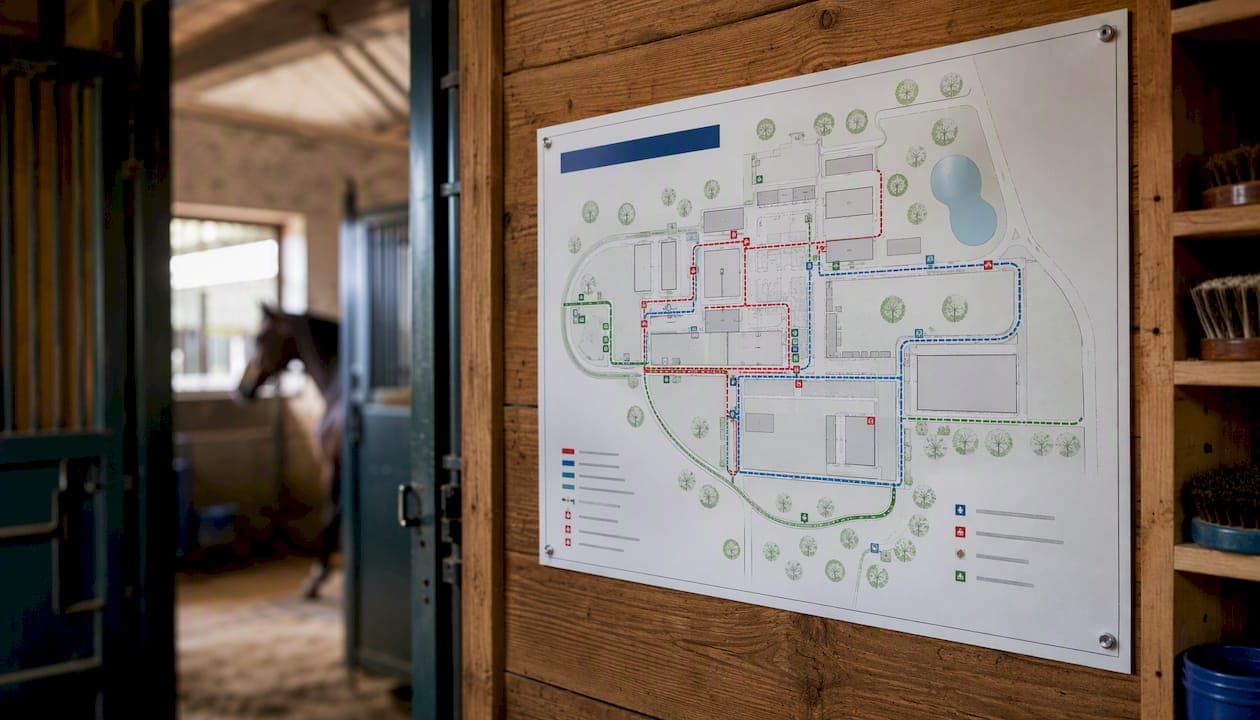
An evacuation route map for an equine facility is a site-specific diagram showing horse movement corridors, muster points, vehicle access routes, gate widths, water points, hazards, and responder notes. Paired with pre-agreed trigger points, it is the single most effective tool for reducing horse trauma and protecting human life during a bushfire, flood, or other emergency. Before reading further, take three immediate steps:
- Assign a map owner — one named person responsible for keeping the map current and accessible.
- Print two copies — one for the house or office, one for each float or vehicle.
- Record your trigger points — write down the Fire Danger Rating or alert level at which horses move, and post it beside the map.
Key takeaways
A site-specific evacuation route map, pre-agreed Fire Danger Rating triggers, and at least one live loading drill each season are the three non-negotiable foundations of equine emergency preparedness in Australia.
| Point | Details |
|---|---|
| Map spec is mandatory | Include gate widths, GPS muster points, alternate routes, water, hazards, and responder notes. |
| Trigger points save lives | Pre-agree a Fire Danger Rating threshold (e.g. Severe) and a departure time (e.g. 05:00) before the season. |
| Drill to validate | Run a biannual live loading drill and a full-route test annually; update the map within 48 hours. |
| Records travel with horses | Carry microchip numbers, photos, vaccination status, and owner contacts in every float. |
| Equibets centralises access | Attach maps and emergency plans to horse records for offline access by staff, vets, and responders. |
Table of Contents
- What must your evacuation route map show?
- How to survey your yard and build a usable map
- When do you evacuate and when do you stay?
- Practical logistics for moving horses safely
- How to choose and prepare a shelter-in-place zone
- Identification, records, and biosecurity
- Drills, maintenance, and keeping maps current
- Digital formats, offline sharing, and how Equibets supports map use
- Safe return procedures after an incident
- Why mapped routes reduce time, stress, and risk
- Equibets makes your evacuation plan work in the field
- Useful Australian resources
- Sources
What must your evacuation route map show?
A map that leaves out a gate width or a water point is a map that fails at 2 AM. Every site-specific evacuation route map for an equine facility should include:
- Property boundary with north arrow and scale bar.
- Vehicle access routes with confirmed widths (minimum clearance for a double float or truck), gate locations, and whether gates are manual or electric.
- Float and truck parking areas with turning circles noted.
- Primary and alternate exit routes — never rely on one road.
- Stable blocks, yards, and paddocks labelled by name or number matching your records.
- Muster points with GPS coordinates noted in decimal degrees.
- Safe paddocks and shelter-in-place zones (low fuel load, open ground).
- Water points — troughs, tanks, and standpipes with approximate capacity.
- Hazards — fuel tanks, large trees, power lines, and low bridges.
- Responder access notes — locked gates, alarm codes, and who to contact on arrival.
Use a consistent colour legend: red for hazards, green for safe zones, blue for water. GPS coordinates on gates and muster points let responders navigate without local knowledge. According to the SES NSW horse safety factsheet, plans should include an emergency horse kit and be practised across different routes and times.
Store printed copies in the house, the yard office, each float, and each tractor cab. Power and mobile networks routinely fail during major incidents, so a printed A3 copy and an offline digital file are non-negotiable.
Pro Tip: Laminate the copy that lives in each float. A wet, illegible map in a smoke-filled paddock is useless.
How to survey your yard and build a usable map
- Assign roles and gather base materials. Nominate a map owner and a backup. Download a satellite image of your property from Google Maps or NSW LPI SIX Maps, or use your existing site plan as the base layer.
- Walk every route with a GPS device or phone. Measure gate widths physically — do not rely on memory. Note choke points (tight corners, overhanging trees, soft ground) and record GPS coordinates for every gate and muster point. Log hazards as you go.
- Draft the map. A clear A3 printable PDF is the minimum output. For digital use, export a georeferenced file (GeoPDF or a geo-tagged PNG) that can be loaded into an offline mapping app. The SES NSW guidance on planning for horses recommends pre-arranging backup transport and alternate holding facilities — note both on the map.
- Name and distribute files consistently. Use the format
YardName_EvacMap_v20260101so everyone knows which version is current. Load the file onto key phones in offline mode, and place a copy in each float.
Run a timed walk-through with your full team before the next fire season. Load one horse, drive the primary route, and time it. That single drill will expose more gaps than any desk review.
When do you evacuate and when do you stay?
The five-phase framework used across Australian emergency planning — Decision, Warning, Withdrawal, Shelter, Return — gives every role a clear trigger and a clear action.
| Phase | Trigger | Key actions | Responsible |
|---|---|---|---|
| Decision | Forecast shows Severe or above | Review map, confirm transport, notify contacts | Yard manager |
| Warning | Severe or Extreme Fire Danger Rating issued | Pre-load gear, catch difficult horses, fuel floats | All staff |
| Withdrawal | Extreme or Catastrophic rating, or local alert | Load and move horses on pre-agreed route | Float driver + handler |
| Shelter | Evacuation impossible or too dangerous | Move horses to safe paddock, remove gear, open gates | Yard manager |
| Return | All-clear from emergency services | Inspect routes, check fencing and water, vet triage | Yard manager + vet |
Agriculture Victoria is direct: on high fire-risk days, leave the night before or very early in the morning. Late evacuation can be fatal. The CFA Victoria planning template recommends using Fire Danger Ratings as the primary trigger, with a pre-agreed rule such as "horses move by 05:00 on any Severe or above day." Subscribe to the VicEmergency app or your state's RFS or SES alert feed and name a backup decision-maker in writing.
SES NSW's guide for animal holding establishments confirms that shelter-in-place is a legitimate and sometimes safer option — document it as a deliberate choice, not a default.
Practical logistics for moving horses safely
Prioritisation. Flag difficult horses, foals, and horses with medical needs in your records with handling notes and their paddock location. These animals need the most time and the most experienced handler — move them first or assign them a dedicated person.
- Difficult to catch or load: flag in records, assign named handler.
- Foals: load with dam, never separately.
- Sick or injured: vet contact pre-notified, move first or shelter with monitoring.
- Valuable or insured animals: owner notified at Warning phase.
Float preparation checklist:
- Full fuel tank and spare tyre checked.
- Keys, lead ropes, and head collars in the cab.
- Bedding and water in the float.
- Emergency contact list and map copy in the cab.
- Float registration and insurance documents accessible.
Staffing model. A minimum of two people per float is the practical floor: one to drive, one to handle horses at the destination. For a yard of 10 or more horses, pre-arrange at least one additional float and driver from a neighbour or commercial transporter before the season starts.
The Brisbane City Council emergency preparedness guideline lists transport arrangements and alternate holding facilities as mandatory plan components.
How to choose and prepare a shelter-in-place zone
Shelter-in-place is not giving up — it is a deliberate, documented decision that can save lives when roads are cut or fire is moving too fast. The RSPCA knowledgebase identifies raised or low-fuel paddocks as the best primary option. SES NSW guidance adds sand arenas, closely grazed ground, and swampy country as lower-risk areas, which should be identified on maps.
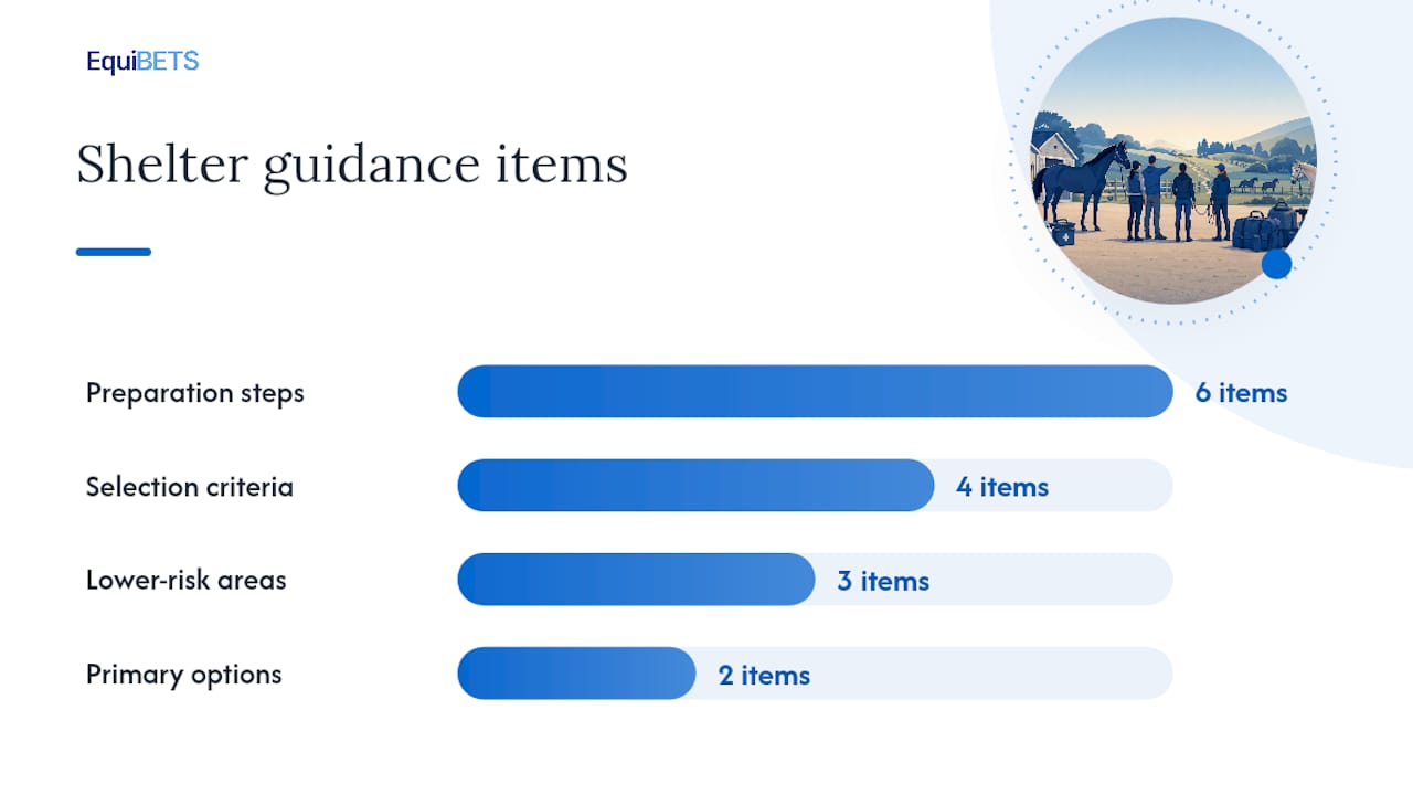
Select a zone that has: low fuel load, reliable water access, enough space for horses to move freely, and clear access for emergency vehicles. Avoid stabling horses in combustible buildings during a fire event.
Preparation steps before an incident:
- Remove all synthetic rugs and gear.
- Open internal gates so horses can move between paddocks.
- Switch off electric fencing.
- Place extra feed and water in the zone.
- Mark the zone clearly on the map with a note for responders: "Horses sheltering here — do not lock gates."
Never risk human life to shelter horses. If conditions deteriorate, leave. Note a fallback contact on the map so responders know who to call about animals left on site.
Identification, records, and biosecurity
Every float should carry a movement sheet for each horse with: microchip number, a recent photo, vaccination status, owner name and mobile number, and the destination address. This takes 20 minutes to prepare and can resolve an ownership dispute or speed a vet triage in minutes.
- Microchip numbers: confirm against your management records before fire season.
- Photos: full body and face, taken within the last 12 months.
- Vaccination records: current copy, especially for Hendra virus.
- Movement records: date, origin, destination, and handler name.
The Horse Venue Biosecurity Workbook from Farm Biosecurity provides ready-made templates for movement records, visitor registers, and an Emergency Disease Action Plan — all directly applicable to relocation and return. Registering horses in the Horse Emergency Contact Database (administered through the Australian Horse Industry Council) gives responders a national contact point for reunification after an event.
On arrival at a destination property, quarantine newly arrived horses from resident stock for at least 48 hours. Use dedicated equipment and limit handler crossover. Biosecurity for horse owners guidance from Horses & People outlines the isolation and equipment sanitation steps needed to prevent disease spread after movement.
Store records in three places: printed copies in each float, a secure cloud folder with offline sync, and a printed set at the house.
Drills, maintenance, and keeping maps current
A map that has not been tested is a theory. Run drills on this schedule:
- Quarterly: table-top walkthrough with all staff — talk through each phase, confirm roles, check contact lists.
- Biannual: live loading drill with at least one float and two horses.
- Annual: full-route test driving the primary and alternate evacuation routes, ideally at night or in reduced visibility.
After each drill, log: time to load per horse, any bottlenecks, equipment that failed or was missing, and any route issues. Update the map within 48 hours of the drill.
Review and update the map whenever: the site layout changes, new horses arrive, transport arrangements change, or state emergency regulations are updated. Set a calendar reminder at the start of each fire season.
Digital formats, offline sharing, and how Equibets supports map use
Recommended file formats for digital evacuation maps:
- GeoPDF — georeferenced, opens in Adobe Acrobat or Avenza Maps offline.
- Geo-tagged PNG — lightweight, easy to share and view on any device.
- GPS waypoints — exported from a phone or GPS unit, importable into most mapping apps.
- Printed A3 PDF — the non-negotiable fallback when power and networks fail.
Attach a QR code to each gate post linking to the offline map file. Staff and responders can scan it with a phone camera without needing a data connection if the file is preloaded.
The Equibets stable management platform supports this directly. Emergency plans and evacuation maps can be attached to horse records and accessed offline via the mobile app. Owner portals push alerts to owners at each phase. Centralised horse records — including microchip numbers, photos, and vet contacts — are available to any authorised team member or responder without a network connection.
Safe return procedures after an incident
Before any horse returns to the property:
- Confirm the route is clear and safe with local emergency services.
- Inspect all fencing, water troughs, and feed storage for damage or contamination.
- Check for downed power lines, unstable trees, and structural damage to stables.
- Have a vet conduct a triage assessment on each horse before readmission.
- Document any injuries with photos and notify insurers within 24 hours.
Hold a debrief with all staff within 48 hours of return. Record what worked, what failed, and what the map missed. Update the map and the plan before the next risk season.
Why mapped routes reduce time, stress, and risk
The most common failure in equine evacuations is not a lack of courage or care — it is a lack of pre-made decisions. When smoke is visible and horses are spinning in their yards, the time to decide which gate to use or who drives which float has already passed.
Mapped muster points remove that decision under pressure. A staff member who has walked the route twice and loaded horses in a drill will move faster and calmer than one reading instructions for the first time. Pre-arranged alternate sites mean a blocked road is a detour, not a crisis.
Single-point transport reliance is the other common failure. One float, one driver, one route — any one of those failing ends the plan. Maps that show alternate routes and plans that name backup transporters convert a single point of failure into a manageable variable, making the plan more resilient.
Equibets makes your evacuation plan work in the field
Producing a map is one step. Getting it into the hands of every float driver, vet, and responder — and keeping it current — is where most yards fall short. Equibets consolidates your emergency plans, horse records, and team coordination in one platform with offline mobile access, so the right information is available when networks go down.

Getting started takes three steps: create your account, upload your evacuation map and emergency contacts, then share access with your team and preload the app on key devices before the season starts. Owner portals keep horse owners informed at each phase without extra calls. All features — farm mapping, emergency plans, owner portals, and stable chat — are included in a single monthly plan.
Start a free trial at Equibets and have your map live on every device before the next fire season.
Useful Australian resources
- VicEmergency app — real-time fire, flood, and incident alerts for Victoria; subscribe to location-based warnings.
- CFA Victoria planning template for horses and bushfires — fillable template covering trigger points, transport, and shelter options.
- SES NSW horse safety factsheet — concise checklist covering emergency kits, identification, and practice runs.
- Agriculture Victoria horses and livestock in emergencies — guidance on early departure decisions and Fire Danger Ratings.
- Horse Venue Biosecurity Workbook (Farm Biosecurity) — movement record templates, visitor registers, and emergency disease action plans.
- Horse Emergency Contact Database (Australian Horse Industry Council) — register your horses so responders can confirm ownership and contact details post-event; search for the AHIC registration portal directly.
- Your local council emergency management page — check for route closures, local flood maps, and community evacuation guides specific to your area before each season.
Sources
- Horses and livestock in emergencies (Agriculture Victoria)
- Emergency preparedness guideline for the commercial animal management industry (Brisbane City Council)
- Horse safety in emergencies (SES NSW factsheet)
- Planning template: horses and bushfires (CFA Victoria)
- Horse industry resources (Farm Biosecurity)