
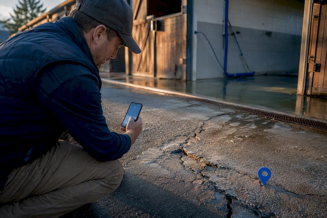
A stable hazard map is a living site plan that marks every risk on your property, ranks each by urgency and assigns someone to fix it. Build it digitally, share it with your whole team, and update it whenever anything on the yard changes. Mark fire risks, evacuation routes and repeat slip or trip spots first, then assign owners and deadlines before you worry about anything else.
TL;DR:
- Fire risks and combustible storage should be mapped and prioritized for immediate control, with frequent updates and clear color coding for safety zones.
- Every identified hazard needs a designated owner, a deadline, and photographic evidence to ensure timely action and accountability.
- Regular site assessments, including weekly spot checks and annual reviews, are essential to maintain an effective and current hazard map.
- Digital, offline-capable maps integrate seamlessly into daily routines and support quick access to emergency details, reducing the risk of stale or inaccessible information.
- Incorporating hazard mapping into staff inductions, drills, and ongoing management creates a safety culture that reduces repeat incidents and improves response times.
Table of Contents
- What to show on your stable hazard map
- How to build your hazard map, rank risk and assign fixes
- Making the map a living tool your whole team can use
- Keeping the map alive: inductions, drills and audits
- Why hazard mapping has to become part of yard culture, not a compliance task
- How EquiBETS supports a living hazard map
- Sources
- FAQ
What to show on your stable hazard map
A hazard map earns its place in daily operations only if it actually shows the things that hurt people and horses. Start with the physical layout: power points, hay and bedding storage, muck heaps, walkways, gates, fixed equipment, and any drainage or paving prone to getting slippery; for effective control of your animals and risks, consider farm dog containment as part of your approach. Layer fire-specific detail on top of that, because fire is the one hazard category where a missed detail can be catastrophic rather than merely painful.
Your map should include:
- Ignition sources (heaters, electrical panels, wiring runs, machinery)
- Combustible storage: hay, straw, shavings, muck heaps, and their distance from buildings
- Extinguisher and hose locations, checked and dated
- Evacuation routes and assembly points for people and for horses separately
- High-frequency "nuisance" hazards: slippery drainage, uneven paving, loose fittings or protrusions
- PPE stations, first aid points, and QR codes on stalls linking to that horse's emergency profile
The Fire Training Company's guidance for equestrian yards recommends mapping combustible storage and extinguisher points specifically, alongside marked routes for both handlers and horses. Colour coding matters more than most managers assume: red for fire and life-safety items, amber for frequent minor hazards like a wet corner near the wash bay, and green for checked and cleared zones. A simple legend on the map itself stops new staff guessing what a symbol means.
Pro Tip: Don't reserve colour coding for catastrophic risks. A wet drainage grate that causes three minor slips a year does more cumulative damage to your workforce than the fire risk you've never had.
How to build your hazard map, rank risk and assign fixes
1. Gather your base materials. Pull your site plan or an aerial image, then walk the property with a tablet or phone, a camera, and a GPS-enabled mapping or equine management app.
2. Sweep every area systematically. Go building by building, paddock by paddock, rather than jumping to the obvious spots. Photograph anything questionable, and tag its location as you go.
3. Rank each hazard by urgency. Split findings into "fix now" (loose wiring, blocked fire exit) and "fix later" (worn paint on a gate latch) using a simple risk matrix that weighs likelihood against severity.
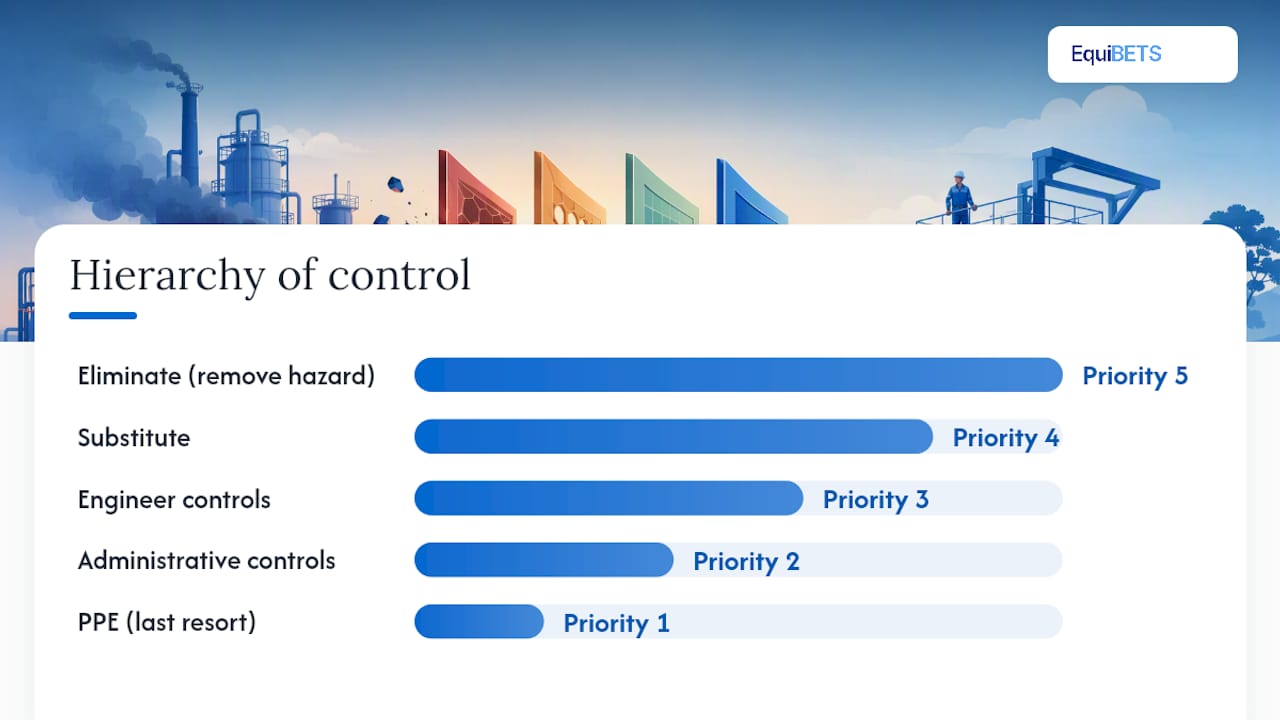
4. Choose controls using the hierarchy of control. WorkSafe Victoria's guidance on stables and track riding sets out the order: eliminate the hazard, substitute it, engineer around it, apply administrative controls, and fall back on PPE only last. A cracked concrete apron near the wash bay is better fixed by re-pouring it (engineering) than by putting up a "caution wet floor" sign (administrative). Re-routing a walkway around a blind gate corner beats signage every time, because removing the hazard from the path works regardless of whether anyone reads the sign.
5. Assign, photograph, and set a deadline. Every open hazard needs a named owner and a date, with a photo attached as evidence once it's closed.
6. Draft evacuation routes with horses in mind, including trailer and float loading points, since a route that works for people on foot can be useless for leading a spooked horse.
7. Set your review cadence. Spot checks weekly or fortnightly, and one formal, scheduled annual review of the whole map and process.
- Loose or exposed wiring near stalls
- Muck heaps sited too close to hay storage
- Gates opening into blind walkway corners
- Worn or missing extinguisher tags
Pro Tip: Run your first full sweep on a quiet day, not during feed time or turnout. Rushed hazard sweeps miss the boring stuff, and the boring stuff is what actually causes most injuries.
Making the map a living tool your whole team can use
A hazard map printed once and pinned in the tack room is already going stale by the time the ink dries. HERE Technologies' comparison of static and dynamic maps makes the point plainly: paper maps fail because nobody updates them and nobody can access them when it matters. A digital, offline-capable map solves both problems at once, since staff can pull it up on a phone in a paddock with no signal and still see the latest version once they're back in range.
The features that actually move the needle:
- Offline-first mobile access, so a hazard sweep doesn't stop when the wifi does
- Owner portals that let horse owners see relevant safety updates without cluttering staff-only views
- QR codes on stall doors linking straight to that horse's emergency profile, medications and vet contact
- GPS-tagged hydrants, extinguishers and assembly points that responders can find without a guided tour
- An audit trail showing who closed which hazard and when
InnoHorse's stable safety research found that digital checklists and safety maps raised awareness and led to concrete fixes, from rubber matting on slippery corridors to better lighting, largely because the tool sat inside daily routines rather than a filing cabinet. That's the real value of integration: a map that lives inside your management platform gets checked because it's already open, not because someone remembered a compliance date.
Sharing the map with your local fire service before a major renovation or new build is worth doing early. Site-specific consultation catches access and hydrant issues a generic checklist never will, and a platform like EquiBETS's emergency plan tools can hold that shared version alongside medication records and emergency contacts, ready for a vet or responder the moment they arrive.
Keeping the map alive: inductions, drills and audits
The map only earns its keep if it's part of how your yard actually runs, not a document that exists for inspection day.
- Day-one induction: walk every new starter through the map and have them point out the nearest extinguisher and two "no-go" zones before their first shift ends.
- Evacuation drills: run one with horses at least annually, timed, and note where the evacuation route breaks down under real movement.
- Weekly or fortnightly spot checks: quick visual sweeps of high-traffic areas, logged against the map.
- Annual formal review: the full four-step loop again — identify, assess, control, monitor — as WorkSafe Victoria recommends.
- Audit trail: store dated photos, closed-hazard records, and drill notes so you can show a trend, not just a snapshot.
Pro Tip: Track your success by what stops happening. Fewer repeat entries in the same paddock corner over six months tells you more than any single audit score.
A yard running the Swedish University of Agricultural Sciences' stable safety map format reports that a compact, one-page checklist covering walkways, PPE, fire safety and rescue planning is easier to keep current than a sprawling document nobody opens twice.
Why hazard mapping has to become part of yard culture, not a compliance task
Most yards treat the hazard map as something you produce once for an insurance audit and then forget. That's backwards. The yards that actually reduce incidents are the ones that fold the map into the handover sheet, the induction walk, and the Monday morning checklist, so checking it becomes as routine as checking water troughs.
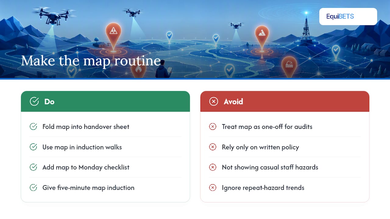
Casual and part-time staff cause a disproportionate share of avoidable incidents simply because nobody showed them where the danger sits. A five-minute map-based induction fixes more of that than any written policy ever will.
Measure success the boring way: fewer repeat hazards in the same three or four spots, faster time between a hazard being flagged and being closed, and quicker response when something does go wrong. If your map isn't producing that trend after a year, the map is the problem, not the yard.
— isaac
How EquiBETS supports a living hazard map
Equibets gives yards a way to keep that hazard map alive instead of letting it sit static in a folder, because EquiBETS's platform is built for offline-first use, so a hazard logged in a paddock with no signal syncs the moment a phone reconnects.

Inside such platforms, flagged hazards can become tasks with owners and deadlines, visible to the team without a second system to check. Owner portals can show horse owners relevant updates without operational details meant for staff, and QR-linked stall views can give vets or responders instant access to medications and emergency contacts when scanned. This is especially valuable in the minutes right after an incident, when quick access to information is critical.
A sensible way to start: pick one building, attach photos and priority ratings to its three or four worst hazards, and run a single tabletop evacuation drill with staff using the map you've built. Once that pilot proves out, scale it across the yard. The Stable Manager module is built for exactly that kind of staged rollout, and a free trial lets you test the offline sync and tasking features against your own site before committing to anything.
Sources
- Horse stables and track riding safety (WorkSafe Victoria)
- Development of a safety management web tool for horse stables (InnoHorse) - PMC
- Horse stable safety map – new tool for managing safety in horse stable activities (SLU)
- Static map vs dynamic map (HERE Technologies blog)
FAQ
What Is a Hazard Map for a Stable?
It's a site plan marking every identified risk on the property, ranked by urgency, with an assigned owner and deadline for fixing each one. The WorkSafe Victoria framework treats it as a continuous cycle: identify, assess, control, monitor.
How Often Should a Stable Hazard Map Be Reviewed?
Run quick spot checks weekly or fortnightly on high-traffic areas, and complete one full formal review annually covering every hazard category from scratch.
Should I Use a Paper Map or a Digital One?
A digital map wins on every practical measure because it updates in real time and stays accessible offline, while paper maps typically go stale within weeks of being pinned up, as HERE Technologies notes.
What Should Go on a Fire-Specific Hazard Map?
Mark ignition sources, combustible storage like hay and bedding, extinguisher and hose locations, and clearly separate evacuation routes for people and horses.
Can EquiBETS Help With Emergency Planning?
Yes. Equibets links hazard data to QR-coded stall views, owner portals and offline-capable tasking, so vets and responders can pull up medications and emergency contacts the moment they arrive on-site.